
Land that fits the brief
A site search built entirely from open data. It takes every registered parcel of land in a search area, tests each one against a brief and returns a shortlist with the reasons each site stayed in or dropped out, and the brief can be anything from a few homes to a wind farm or a power station.
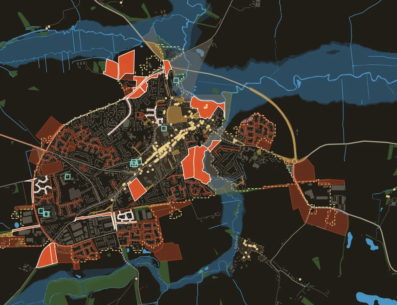
What the search does
Most site searches start from what is being offered for sale, whereas this one starts from every parcel of land and lets the brief decide, whether that brief is for homes, energy or infrastructure.
- Status
- Research
- Purpose
- Find land that matches a brief, before it is offered for sale
- Sector
- Land for housing, energy and infrastructure
- Scope
- Any area of England, set by a postcode and a radius; shown here for a market town
It shows how we apply systems modelling and data integration to the first question any developer or promoter asks: where could this go?
How we went about it
The same search for homes, wind turbines or a power station
Whatever is being built, the first question is where it could go, and the search stays the same whilst the brief sets the filters.
One brief, worked through: homes on a town edge
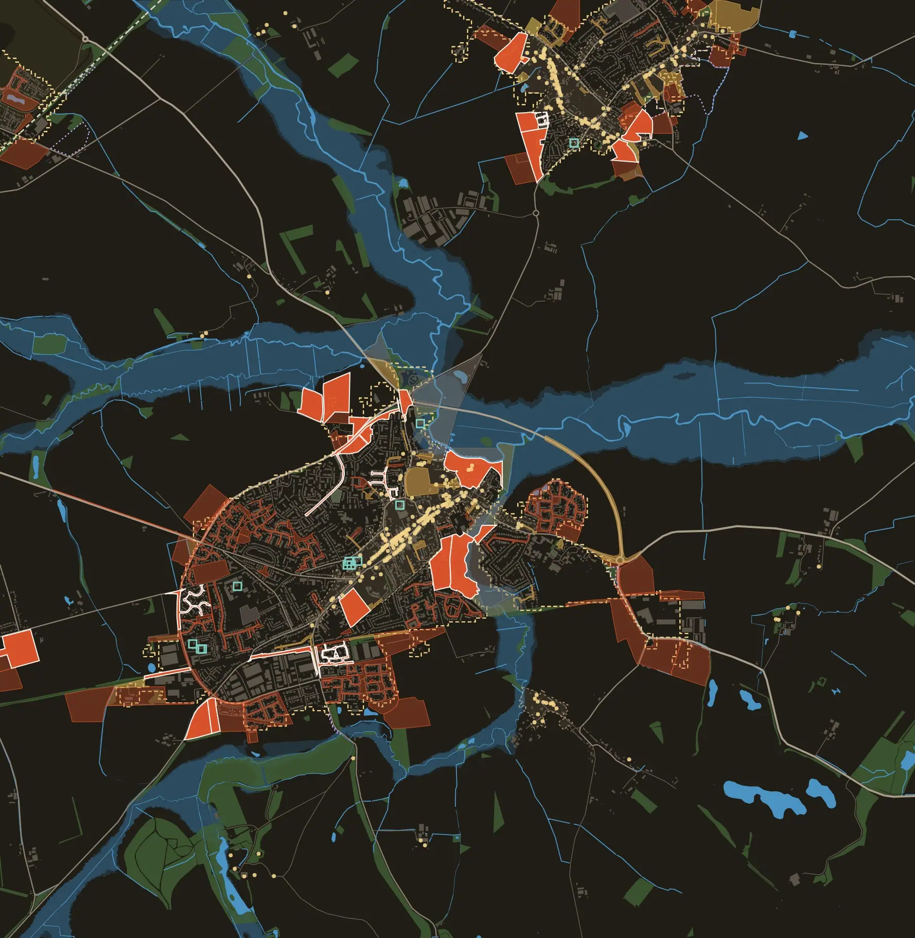
- Shortlisted site
- Other candidate, no constraint found
- Soft constraint, such as a conservation area or flood zone 2
- Hard constraint, such as flood zone 3 or land already allocated
- Flood zones 2 and 3
- Woodland
- Rivers and water
- Best agricultural land
- Conservation area
- Settlement edge
- Listed building
- Brownfield register site
- Unregistered land
Every layer comes from open data. The map is mirrored and unlabelled so the town cannot be identified.
How the search works
Each layer comes from a public source, so that the reasoning behind every site can be traced.
- LocateA postcode and a radius set the search area, its settlements and the infrastructure that matters to the brief.
- ParcelsRegistered land title boundaries become the candidate sites, filtered by the size and position the brief needs.
- ConstraintsGreen belt, flood zones, protected landscapes and habitats, heritage, land grade and allocations are tested against each parcel.
- Site qualitiesAccess, slope and aspect from terrain data, views, ground conditions, services and the distances the brief sets.
- EvidenceLocal planning history, approval rates, land prices and policy, to show the odds as well as the fit.
The result is a page with a constraint map, a scored table of parcels with grid references and the flags behind each score, and a shortlist that can be reweighted as the brief changes. Community information, such as schools and their capacity, is shown for context and is not scored.
What the search does and does not claim
It finds and ranks candidates, but it does not establish that a site is available, buildable or likely to be consented.
- Open data only. Land title boundaries show where parcels are, not who owns them or on what terms. Ownership needs a title search.
- Settlement edges. Where a council publishes its development limits, the search uses them. Otherwise official built-up areas stand in, and the page says so.
- England first. Terrain, flood and planning-policy layers are wired for England. Gaps for Wales, Scotland and Northern Ireland are listed with their official sources.
- Not planning advice. Scores reflect the brief and the data. Local policy, site visits and professional judgement come next.
Related solutions and services
Finding the site is the first of the decisions a scheme has to get right, whatever the scheme is.
Try it with your own brief
Homes, turbines or a power station: tell us what the land has to offer and where. We can run the search and talk through what it finds.
Start a conversation